

JAMES O'KELLY ca. 1735-1826

Founded the Christian Church, after dissenting from Methodist-Episcopal Church, 1792. His grave is 4 miles south.Plaque via North Carolina Highway Historical Marker Program, and is used with...
- ncmarkers
- north carolina
WILLIAM A. GRAHAM

Governor, 1845-1849; Secretary of the Navy; United States Senator; Whig nominee for Vice-President in 1852. His home stands 150 yds. W.Plaque via North Carolina Highway Historical Marker Program,...
- ncmarkers
- north carolina
WILLIAM HOOPER 1742-1790
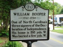
One of North Carolina's three signers of the Declaration of Independence. His home is 150 yds. W. Was buried a few yds. W.Plaque via North Carolina Highway Historical Marker Program, and is used...
- ncmarkers
- north carolina
TRADING PATH

Colonial trading route, dating from 17th century, from Petersburg, Virginia, to Catawba and Waxhaw Indians in Carolina, passed nearby.Plaque via North Carolina Highway Historical Marker...
- ncmarkers
- north carolina
HILLSBOROUGH ACADEMY

Classical academy opened in 1801 and rechartered, 1814. William J. Bingham was principal, 1827-1844. Closed 1858. Campus here.Plaque via North Carolina Highway Historical Marker Program, and is...
- ncmarkers
- north carolina
HENRY G. CONNOR 1852-1924

Justice of N.C. Supreme Court; Federal District Judge; state legislator. Grave is 3.5 mi. west.Plaque via North Carolina Highway Historical Marker Program, and is used with their permission. Full...
- ncmarkers
- north carolina
HAWFIELDS CHURCH

Presbyterian, founded about 1755, three miles N.E. Henry Patillo the first pastor. Present building erected 1852.Plaque via North Carolina Highway Historical Marker Program, and is used with...
- ncmarkers
- north carolina
THOMAS BURKE
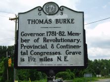
Governor, 1781-82. Member of Revolutionary, Provincial, & Continental Congresses. Grave is 1 1/2 miles N.E.Plaque via North Carolina Highway Historical Marker Program, and is used with...
- ncmarkers
- north carolina
STAGVILLE
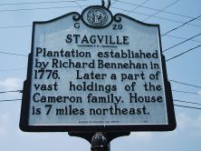
Plantation established by Richard Bennehan in 1776. Later a part of vast holdings of the Cameron family. House is 7 miles northeast.Plaque via North Carolina Highway Historical Marker Program, and...
- ncmarkers
- north carolina
WILLIE P. MANGUM

Member of United States Senate for 18 years and president pro tempore, 1842-45; Congressman; Whig party leader. Home site, grave, 10 mi. N.E.Plaque via North Carolina Highway Historical...
- ncmarkers
- north carolina
HORNER MILITARY SCHOOL

Established here by James H. Horner, 1851. Continued by his sons. Moved to Charlotte 1914.Plaque via North Carolina Highway Historical Marker Program, and is used with their permission. Full page...
- ncmarkers
- north carolina
THOMAS H. BENTON
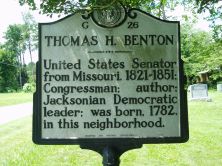
United States Senator from Missouri, 1821-1851; Congressman; author; Jacksonian Democratic leader; was born, 1782, in this neighborhood.Plaque via North Carolina Highway Historical Marker...
- ncmarkers
- north carolina
RED HOUSE CHURCH

Presbyterian. Founded about middle of 18th century. Hugh McAden, its noted pastor, was buried in the churchyard, 1781. One mi. S.Plaque via North Carolina Highway Historical Marker Program, and is...
- ncmarkers
- north carolina
BATTLE OF ALAMANCE

The militia under royal Governor Tryon defeated the Regulators at this point, May 16, 1771.Plaque via North Carolina Highway Historical Marker Program, and is used with their permission. Full page...
- ncmarkers
- north carolina
REGULATORS HANGED

After the Regulators were defeated at Alamance, May 16, 1771, six of their number were hanged, 1/4 mile east, June 19, 1771.Plaque via North Carolina Highway Historical Marker Program, and is...
- ncmarkers
- north carolina
PYLE'S DEFEAT

Tory militia going to join Cornwallis's army destroyed by Lee's Legion Feb. 1781 nearby on Col. Michael Holt's land.Plaque via North Carolina Highway Historical Marker Program, and is used with...
- ncmarkers
- north carolina
LINDLEY'S MILL

In a battle on Sept. 13, 1781, John Butler's Whig militia failed to rescue Governor Thomas Burke from Col. David Fanning's Tories. Site 4 mi. S.W.Plaque via North Carolina Highway...
- ncmarkers
- north carolina
WILLIAMSBOROUGH

Eighteenth century town, named for John Williams, judge, state legislator, congressman, who lived nearby. Old St. John's Church is here.Plaque via North Carolina Highway Historical Marker...
- ncmarkers
- north carolina
BATTLE OF ALAMANCE

Militia under Governor William Tryon defeated Regulators on May 16, 1771. Six miles S.W.Plaque via North Carolina Highway Historical Marker Program, and is used with their permission. Full page...
- ncmarkers
- north carolina
EDMUND FANNING

Born in New York, Yale graduate, judge. His home nearby, destroyed by Regulators, 1770. Later Loyalist, British general, governor.Plaque via North Carolina Highway Historical Marker Program, and...
- ncmarkers
- north carolina