

JAMES SPRUNT

Author of "Chronicles of the Cape Fear River" (1914), cotton merchant, philanthropist, British vice consul. His home stands two blocks west.Plaque via North Carolina Highway Historical Marker...
- ncmarkers
- north carolina
HENRY BACON 1866-1924

Architect of the Lincoln Memorial in Washington and many other public structures. Home is here, grave, Oakdale Cemetery.Plaque via North Carolina Highway Historical Marker Program, and is...
- ncmarkers
- north carolina
ST. JAMES CHURCH

Built 1839, near site of older church, begun about 1751. Graves of Cornelius Harnett and Thomas Godfrey.Plaque via North Carolina Highway Historical Marker Program, and is used with...
- ncmarkers
- north carolina
THALIAN HALL CITY HALL

Built 1855-58 as city hall and theatre for the Thalian Association (amateur), formed c. 1788.Plaque via North Carolina Highway Historical Marker Program, and is used with their permission. Full...
- ncmarkers
- north carolina
EDWARD MOSELEY

Published landmark map, 1733. Surveyor general; chief justice of General Court. Member of colonial Councils and Assemblies. His home was nearby.Plaque via North Carolina Highway Historical Marker...
- ncmarkers
- north carolina
WILLIAM HOOPER

One of North Carolina's three signers of the Declaration of Independence. Home was here.Plaque via North Carolina Highway Historical Marker Program, and is used with their permission. Full page...
- ncmarkers
- north carolina
TEMPLE OF ISRAEL

Erected 1875-6. First house of worship built in North Carolina by the Jews. Congregation established in 1867.Plaque via North Carolina Highway Historical Marker Program, and is used with their...
- ncmarkers
- north carolina
JOHN A. WINSLOW

Capt. U.S.S. "Kearsarge," which sank Confederate raider "Alabama," 1864, rear admiral U.S. Navy, 1870-1873. Birthplace was one block west.Plaque via North Carolina Highway Historical...
- ncmarkers
- north carolina
WILLIAM W. LORING

Major general in the Confederate Army, lieut. colonel in Mexican War, general in Egyptian Army, 1870-79. His birthplace was 1 bl. W.Plaque via North Carolina Highway Historical Marker Program, and...
- ncmarkers
- north carolina
JAMES GIBBONS

Cardinal of the Roman Catholic Church, 1886-1921. Installed as vicar apostolic of North Carolina (1868-72) at St. Thomas Church 1/2 bl. W.Plaque via North Carolina Highway Historical...
- ncmarkers
- north carolina
EDWIN A. ALDERMAN

Crusader for education. President, UNC, 1896-1900; Tulane, 1900-04; Virginia, 1904-31. This was his birthplace.Plaque via North Carolina Highway Historical Marker Program, and is used with...
- ncmarkers
- north carolina
STAMP ACT

Resisted by armed band, Feb., 1766, at Brunswick, where Royal Governor Tryon lived. Site 18-3/4 mi. south.Plaque via North Carolina Highway Historical Marker Program, and is used with their...
- ncmarkers
- north carolina
THOMAS F. PRICE

Roman Catholic priest, pioneer Home Missionary of N.C. Co-founder of "Maryknoll Fathers," a foreign mission society. Birthplace (1860) 1 bl. E.Plaque via North Carolina Highway Historical...
- ncmarkers
- north carolina
MARY BAKER GLOVER EDDY

Founder of Christian Science Church. Spent part of 1844 at Hanover House, 2 blocks west.Plaque via North Carolina Highway Historical Marker Program, and is used with their permission. Full page...
- ncmarkers
- north carolina
CAPTAIN JOHNSTON BLAKELEY

After many victories, War of 1812, was lost at sea with his ship. Home was 2 blocks W.Plaque via North Carolina Highway Historical Marker Program, and is used with their permission. Full page...
- ncmarkers
- north carolina
GEORGE DAVIS 1820-1896

Confederate senator, 1862-64, and attorney general, 1864-65. Home was 2 blocks E.; grave is 1/2 mile northeast.Plaque via North Carolina Highway Historical Marker Program, and is used with their...
- ncmarkers
- north carolina
GEORGE DAVIS
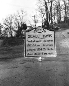
Confederate Senator, 1862-64, and Attorney General, 1864-65. Birthplace stood 3 mi. east.Plaque via North Carolina Highway Historical Marker Program, and is used with their permission. Full page...
- ncmarkers
- north carolina
WELSH TRACT

About 1730 a group of Welsh from the colony of Pennsylvania settled in this area, between the Northeast and Cape Fear rivers.Plaque via North Carolina Highway Historical Marker Program, and...
- ncmarkers
- north carolina
STAG PARK

Named by Barbadian explorers, 1663. Home of Gov. George Burrington and Samuel Strudwick, colonial official. The house stood 3/4 mi. E.Plaque via North Carolina Highway Historical Marker...
- ncmarkers
- north carolina
GEORGE BURRINGTON ca. 1682-1759

Colonial governor, 1724-1725, 1731-1734; opened lower Cape Fear region to settlement. His home was 3/4 mile east.Plaque via North Carolina Highway Historical Marker Program, and is used with...
- ncmarkers
- north carolina