
CAMP MACKALL

Primary training site for U.S. Army airborne troops in World War II. Established 1943; named for Private John Thomas Mackall. Two miles W.Plaque via North Carolina Highway Historical Marker...
- ncmarkers
- north carolina
THOMAS ROBESON

Colonel in Revolution, member of provincial congresses and state senator. Robeson County is named for him. His home stood 1/2 mile N.E.Plaque via North Carolina Highway Historical Marker Program,...
- ncmarkers
- north carolina
MONROE'S CROSSROADS

Gen. Kilpatrick's Union cavalry repulsed Gen. Hampton's Confederate cavalry there, March 10, 1865, ten miles north. Now in Fort Bragg area.Plaque via North Carolina Highway Historical Marker...
- ncmarkers
- north carolina
JOHN WILLIS

Founder of Lumberton, captain in Revolution, later brigadier general; member of legislature, conventions of 1788, '89. Plantation was here.Plaque via North Carolina Highway Historical Marker...
- ncmarkers
- north carolina
ANGUS W. McLEAN
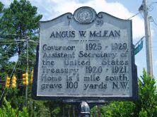
Governor, 1925-1929, Assistant Secretary of the United States Treasury, 1920-1921. Home is 1 mile south, grave 100 yards N.W.Plaque via North Carolina Highway Historical Marker Program, and...
- ncmarkers
- north carolina
MOORE'S CAMP

Prior to the Battle of Moores Creek Bridge, forces of Gen. James Moore, Whig commander, camped, Feb. 15-21, 1776, 1 1/2 miles northeast.Plaque via North Carolina Highway Historical Marker...
- ncmarkers
- north carolina
JAMES C. DOBBIN

Secretary of United States Navy, 1853-57. Helped found State Hospital for Insane. Home one block north.Plaque via North Carolina Highway Historical Marker Program, and is used with their...
- ncmarkers
- north carolina
EDENBOROUGH MEDICAL COLLEGE

Early medical school, chartered 1867, conducted by Dr. Hector McLean. Closed c. 1877. Stood one-half mile south.Plaque via North Carolina Highway Historical Marker Program, and is used with...
- ncmarkers
- north carolina
THOMAS O. MOORE 1804-1876

Governor of Louisiana, 1860-1864; a leader of the secession movement. His birthplace stood 4 1/2 miles northwest.Plaque via North Carolina Highway Historical Marker Program, and is used with...
- ncmarkers
- north carolina
FAYETTEVILLE STATE UNIVERSITY

Est. 1867 as Howard School. State-supported since 1877. A part of The University of North Carolina since 1972.Plaque via North Carolina Highway Historical Marker Program, and is used with...
- ncmarkers
- north carolina
UNIVERSITY OF N.C. AT PEMBROKE

Established 1887 as the State Normal School for Indians. Since 1972 a campus of The University of North Carolina.Plaque via North Carolina Highway Historical Marker Program, and is used with...
- ncmarkers
- north carolina
JOHN CHARLES McNEILL

Notable North Carolina poet, 1874-1907. House in which he was born restored at his burial site 1 1/2 miles west.Plaque via North Carolina Highway Historical Marker Program, and is used with...
- ncmarkers
- north carolina
CONFEDERATE BREASTWORKS

Thrown up early in 1865 to defend Fayetteville from Sherman's army. Remains are here.Plaque via North Carolina Highway Historical Marker Program, and is used with their permission. Full page...
- ncmarkers
- north carolina
FIRST PRESBYTERIAN CHURCH

Organized in 1800. The original building, begun in 1816, rebuilt on same walls after fire of 1831, stands one block east.Plaque via North Carolina Highway Historical Marker Program, and is...
- ncmarkers
- north carolina
CAROLINA COLLEGE
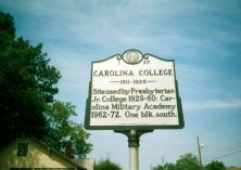
Operated by Methodist Church, 1911-1926. Site used by Presbyterian Jr. College, 1929-1960; Carolina Military Academy, 1962-1972. One block S.Plaque via North Carolina Highway Historical...
- ncmarkers
- north carolina
ROBERT STRANGE

U.S. Senator, 1836-40; author of "Eoneguski, or Cherokee Chief," first novel about North Carolina (1839). Home and grave are 350 yds. east.Plaque via North Carolina Highway Historical...
- ncmarkers
- north carolina
UNION HEADQUARTERS

Maj. Gen. H. W. Slocum, commanding Sherman's Left Wing, had headquarters in this field, March 19-21, 1865.Plaque via North Carolina Highway Historical Marker Program, and is used with their...
- ncmarkers
- north carolina
FEDERAL ARTILLERY

Union batteries (26 guns) formed a line here, March 19. These guns covered retreating Federals during the Confederate charges and finally halted the advance of the Confederate Right...
- ncmarkers
- north carolina
LAFAYETTE

On March 4-5, 1825, was guest of Fayetteville (named for him 1783), staying at home of Duncan McRae, on site of present courthouse.Plaque via North Carolina Highway Historical Marker Program, and...
- ncmarkers
- north carolina
FLORAL COLLEGE

One of earliest colleges for women in the South, 1841-78. Centre Presbyterian Church, formerly the college chapel, is 150 yards north.Plaque via North Carolina Highway Historical Marker...
- ncmarkers
- north carolina