

FIRST PRINTING PRESS IN N.C.

Est. 1749 by James Davis who published the first book & newspaper in colony. Shop was nearby.Plaque via North Carolina Highway Historical Marker Program, and is used with their permission....
- ncmarkers
- north carolina
D. L. RUSSELL
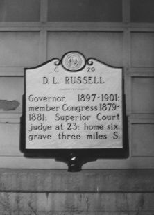
Governor, 1897-1901; member Congress 1879-1881; Superior Court judge at 23; home six, grave three miles S.Plaque via North Carolina Highway Historical Marker Program, and is used with...
- ncmarkers
- north carolina
FIRST POST ROAD

The road from New England to Charleston, over which mail was first carried regularly in North Carolina, 1738-39, passed near this spot.Plaque via North Carolina Highway Historical Marker Program,...
- ncmarkers
- north carolina
DE BRETIGNY
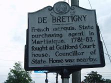
French marquis, State purchasing agent in Martinique, 1781-82, fought at Guilford Courthouse, Councillor of State. Home was nearby.Plaque via North Carolina Highway Historical Marker Program, and...
- ncmarkers
- north carolina
OTWAY BURNS
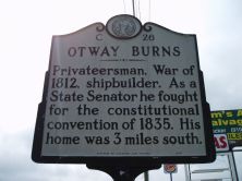
Privateersman, War of 1812, shipbuilder. As a State Senator he fought for the constitutional convention of 1835. His home was 3 miles south.Plaque via North Carolina Highway Historical Marker...
- ncmarkers
- north carolina
FORT POINT

Site of Fort Caswell, built by N.C., 1775-76, to protect New Bern, renamed Fort Lane by Confederacy. Taken by U.S., Mar., 1862. 1/2 mi. E.Plaque via North Carolina Highway Historical Marker...
- ncmarkers
- north carolina
CAPE LOOKOUT LIGHTHOUSE

Constructed, 1857-1859, to replace original 1812 tower. Present lighthouse, 150 feet tall, is four miles south.Plaque via North Carolina Highway Historical Marker Program, and is used with...
- ncmarkers
- north carolina
STREETS FERRY

Established near here before 1730 by Richard Graves. Named for later owner Samuel Street. Replaced by bridge, 1961.Plaque via North Carolina Highway Historical Marker Program, and is used with...
- ncmarkers
- north carolina
FIRST POST ROAD

The road from New England to Charleston, over which mail was first carried regularly in North Carolina, 1738-39, passed near this spot.Plaque via North Carolina Highway Historical Marker Program,...
- ncmarkers
- north carolina
WHALE FISHERY

At Shackleford Banks, six miles southeast by boat, was located a whale fishery of the 18th and 19th centuries.Plaque via North Carolina Highway Historical Marker Program, and is used with...
- ncmarkers
- north carolina
BAYARD v. SINGLETON
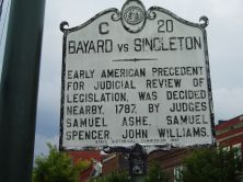
American precedent for judicial review of legislation set nearby, 1787, by Samuel Ashe, Samuel Spencer, John Williams.Plaque via North Carolina Highway Historical Marker Program, and is used with...
- ncmarkers
- north carolina
TRYON PALACE

Historic Capitol and Governor's residence of N.C., 1770-1794. Burned 1798, and restored in 1952-1959. Open to the public. One block south.Plaque via North Carolina Highway Historical Marker...
- ncmarkers
- north carolina
WASHINGTON'S SOUTHERN TOUR

President Washington visited in the Stanly home two nights, April 20-21, 1791.Plaque via North Carolina Highway Historical Marker Program, and is used with their permission. Full page here...
- ncmarkers
- north carolina
WASHINGTON'S SOUTHERN TOUR

President Washington spent the night Apr. 23, 1791 at Sage's Inn, which stood 200 yds. E.Plaque via North Carolina Highway Historical Marker Program, and is used with their permission. Full page...
- ncmarkers
- north carolina
WASHINGTON'S SOUTHERN TOUR
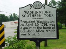
President Washington, on April 20, 1791, was a guest at the home of Col. John Allen, which was 5 mi. E.Plaque via North Carolina Highway Historical Marker Program, and is used with their...
- ncmarkers
- north carolina
WASHINGTON'S SOUTHERN TOUR

President Washington spent the night, April 22, 1791, at Shine's Inn which was 7 mi. S.W.Plaque via North Carolina Highway Historical Marker Program, and is used with their permission. Full page...
- ncmarkers
- north carolina
SHINE HOME

Built about 1815-16 by James Shine. President Monroe & Secretary of War Calhoun spent the night there, April 13, 1819. Stands 1 mile S.Plaque via North Carolina Highway Historical Marker...
- ncmarkers
- north carolina
GEORGE E. BADGER
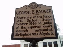
Secretary of the Navy, 1841; United States Senator, 1846-55; judge of the superior court; staunch nationalist. Birthplace was 80 yds S.Plaque via North Carolina Highway Historical Marker Program,...
- ncmarkers
- north carolina
SALT WORKS
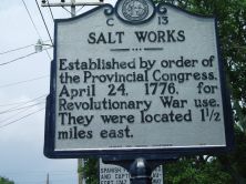
Established by order of the Provincial Congress, April 24, 1776, for Revolutionary War use. They were located 1 1/2 miles east.Plaque via North Carolina Highway Historical Marker Program, and...
- ncmarkers
- north carolina
FORT TOTTEN

Here stood one of the forts built around New Bern by Union forces after they took the town in March, 1862.Plaque via North Carolina Highway Historical Marker Program, and is used with their...
- ncmarkers
- north carolina