

TEACHER'S ASSEMBLY (NORTH CAROLINA EDUCATION ASSN.)

Headquarters and annual meeting-place, 1888-1900; razed 1934. The building stood here.Plaque via North Carolina Highway Historical Marker Program, and is used with their permission. Full page...
- ncmarkers
- north carolina
OCRACOKE INLET

Once chief trade inlet of N.C. In 1718 pirate "Blackbeard" was killed near there, 17 mi. N.E., across Pamlico Sound.Plaque via North Carolina Highway Historical Marker Program, and is used with...
- ncmarkers
- north carolina
ONSLOW RAID

Federal gunboat Ellis attacked this town Nov. 23, 1862, then ran aground downstream. It was abandoned under Confederate crossfire.Plaque via North Carolina Highway Historical Marker Program, and...
- ncmarkers
- north carolina
LOT BALLARD HOUSE

Bishop Francis Asbury stopped there many times between 1799 and 1815 on visits to New River Chapel. House was 3/4 mi. W.Plaque via North Carolina Highway Historical Marker Program, and is used...
- ncmarkers
- north carolina
CORE SOUND MEETING

Quaker center for more than 100 yrs. after 1733. Migration west was one cause of decline. Meeting house was 50 yards W.Plaque via North Carolina Highway Historical Marker Program, and is used with...
- ncmarkers
- north carolina
RICHLANDS OF NEW RIVER CHAPEL
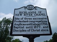
Site of three successive Protestant congregations: Anglican until about 1758; Baptist until 1877; and Disciples of Christ since.Plaque via North Carolina Highway Historical Marker Program, and...
- ncmarkers
- north carolina
JAMES WALKER HOOD

Asst. Superintendent Public Instruction, 1868-70; a founder Livingstone College, 1885; Bishop A.M.E. Zion Church; founded St. Peters, 1864. One blk. N.Plaque via North Carolina Highway...
- ncmarkers
- north carolina
FORT BARNWELL

Constructed by Colonel John Barnwell of South Carolina in campaign against the Tuscarora Indians in April, 1712. Remains are 2 mi. N. E.Plaque via North Carolina Highway Historical Marker...
- ncmarkers
- north carolina
EDWARD B. DUDLEY 1789-1855

Governor, 1836-41, the first in N.C. elected by popular vote, first president of Wilmington and Weldon Railroad. Birthplace was 2 mi. W.Plaque via North Carolina Highway Historical Marker...
- ncmarkers
- north carolina
F. M. SIMMONS 1854-1940

U.S. Senator, 1901-1931. Chaired Senate Finance Committee during World War I. U.S. House, 1887-1889. Lived here.Plaque via North Carolina Highway Historical Marker Program, and is used with their...
- ncmarkers
- north carolina
FIRST PRINTING PRESS IN N.C.

Est. 1749 by James Davis who published the first book & newspaper in colony. Shop was nearby.Plaque via North Carolina Highway Historical Marker Program, and is used with their permission....
- ncmarkers
- north carolina
D. L. RUSSELL
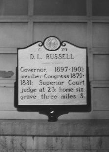
Governor, 1897-1901; member Congress 1879-1881; Superior Court judge at 23; home six, grave three miles S.Plaque via North Carolina Highway Historical Marker Program, and is used with...
- ncmarkers
- north carolina
FIRST POST ROAD

The road from New England to Charleston, over which mail was first carried regularly in North Carolina, 1738-39, passed near this spot.Plaque via North Carolina Highway Historical Marker Program,...
- ncmarkers
- north carolina
DE BRETIGNY
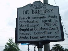
French marquis, State purchasing agent in Martinique, 1781-82, fought at Guilford Courthouse, Councillor of State. Home was nearby.Plaque via North Carolina Highway Historical Marker Program, and...
- ncmarkers
- north carolina
OTWAY BURNS
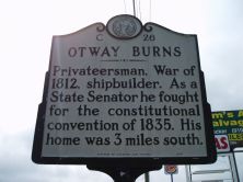
Privateersman, War of 1812, shipbuilder. As a State Senator he fought for the constitutional convention of 1835. His home was 3 miles south.Plaque via North Carolina Highway Historical Marker...
- ncmarkers
- north carolina
FORT POINT

Site of Fort Caswell, built by N.C., 1775-76, to protect New Bern, renamed Fort Lane by Confederacy. Taken by U.S., Mar., 1862. 1/2 mi. E.Plaque via North Carolina Highway Historical Marker...
- ncmarkers
- north carolina
CAPE LOOKOUT LIGHTHOUSE

Constructed, 1857-1859, to replace original 1812 tower. Present lighthouse, 150 feet tall, is four miles south.Plaque via North Carolina Highway Historical Marker Program, and is used with...
- ncmarkers
- north carolina
STREETS FERRY

Established near here before 1730 by Richard Graves. Named for later owner Samuel Street. Replaced by bridge, 1961.Plaque via North Carolina Highway Historical Marker Program, and is used with...
- ncmarkers
- north carolina
FIRST POST ROAD

The road from New England to Charleston, over which mail was first carried regularly in North Carolina, 1738-39, passed near this spot.Plaque via North Carolina Highway Historical Marker Program,...
- ncmarkers
- north carolina
WHALE FISHERY

At Shackleford Banks, six miles southeast by boat, was located a whale fishery of the 18th and 19th centuries.Plaque via North Carolina Highway Historical Marker Program, and is used with...
- ncmarkers
- north carolina