

PENDERLEA HOMESTEADS

Established in 1934 as model farm community. Planned as a New Deal homesteading project of ten thousand acres.Plaque via North Carolina Highway Historical Marker Program, and is used with...
- ncmarkers
- north carolina
JAMES INNES ca. 1700-1759
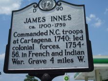
Commanded N.C. troops at Cartagena, 1740; led colonial forces, 1754-56, in French and Indian War. Grave 4 miles W.Plaque via North Carolina Highway Historical Marker Program, and is used with...
- ncmarkers
- north carolina
WHISTLER'S MOTHER

Anna McNeill Whistler, the mother of James Whistler, artist, was born in a house which stood one block east.Plaque via North Carolina Highway Historical Marker Program, and is used with...
- ncmarkers
- north carolina
JOSIAH MARTIN

Last royal governor of North Carolina, 1771-75. Fearing capture, in June 1775 he sought refuge here. Fled offshore to HMS Cruizer in July.Plaque via North Carolina Highway Historical...
- ncmarkers
- north carolina
GREGORY NORMAL INSTITUTE

School for blacks, 1868-1921. Founded by American Missionary Assoc. Named for benefactor James H. Gregory. Was 4 blocks E.Plaque via North Carolina Highway Historical Marker Program, and is...
- ncmarkers
- north carolina
THOMAS ATKINSON 1807-1881
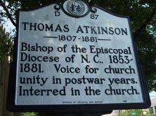
Bishop of the Episcopal Diocese of N.C., 1853-1881. Voice for church unity in postwar years. Interred in the church.Plaque via North Carolina Highway Historical Marker Program, and is used with...
- ncmarkers
- north carolina
USS NORTH CAROLINA

World War II battleship. Launched, June 13, 1940. Served in Pacific, 1942-1945. Decommissioned, 1947. Berthed here, 1961.Plaque via North Carolina Highway Historical Marker Program, and is...
- ncmarkers
- north carolina
BENJAMIN SMITH 1756-1826
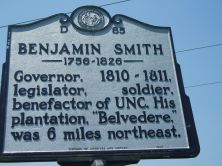
Governor, 1810-1811, legislator, soldier, benefactor of UNC. His plantation, "Belvedere," was 6 miles northeast.Plaque via North Carolina Highway Historical Marker Program, and is used with their...
- ncmarkers
- north carolina
N.C. BUILDING AND LOAN ASSOCIATION LEAGUE

Organized on June 25, 1903, at Seashore Hotel nearby. First president was Samuel Wittkowsky.Plaque via North Carolina Highway Historical Marker Program, and is used with their permission. Full...
- ncmarkers
- north carolina
JAMES F. SHOBER 1853-1889

1st known black physician with an M.D. degree in N.C. Practiced 1878-89. Home and office stood one block north.Plaque via North Carolina Highway Historical Marker Program, and is used with...
- ncmarkers
- north carolina
RUSSELLBOROUGH

Home of royal governors Dobbs and Tryon. Site of Stamp Act resistance in 1765. Burned in American Revolution.Plaque via North Carolina Highway Historical Marker Program, and is used with...
- ncmarkers
- north carolina
THOMAS F. WOOD 1841-1892

Organizer & Sec.-Treas. of State Board of Health, 1877-1892. Founded N.C. Medical Journal in 1878. Home was 1 block west.Plaque via North Carolina Highway Historical Marker Program, and is...
- ncmarkers
- north carolina
UNIVERSITY OF N.C. AT WILMINGTON

Est. 1947 as Wilmington College. Moved here in 1961. A campus of The University of North Carolina since 1969.Plaque via North Carolina Highway Historical Marker Program, and is used with...
- ncmarkers
- north carolina
FORT CASWELL
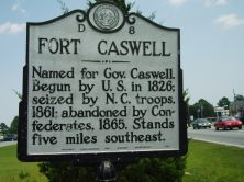
Named for Gov. Caswell. Begun by U.S. in 1826; seized by N.C. troops, 1861; abandoned by Confederates, 1865. Stands five miles southeast.Plaque via North Carolina Highway Historical Marker...
- ncmarkers
- north carolina
FORT CASWELL

Named for Gov. Caswell. Begun by U.S. in 1826; seized by N.C. troops, 1861; abandoned by Confederates, 1865. Stands five miles southeast.Plaque via North Carolina Highway Historical Marker...
- ncmarkers
- north carolina
BOUNDARY HOUSE

Commissioners met here to run boundary in 1764. Popular stop for colonial travelers. Ruins used to est. present state line in 1928. Located 2 3/4 mi. S.E.Plaque via North Carolina Highway...
- ncmarkers
- north carolina
ST. MARK'S
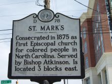
Consecrated in 1875 as first Episcopal church for colored people in North Carolina. Served by Bishop Atkinson. Is located 3 blocks east.Plaque via North Carolina Highway Historical Marker...
- ncmarkers
- north carolina
ST. STEPHEN A.M.E. CHURCH

Congregation formed in 1865. Present church constructed 1880 on land donated by Geo. Peabody. Located 2 blocks east.Plaque via North Carolina Highway Historical Marker Program, and is used with...
- ncmarkers
- north carolina
NORTH CAROLINA SOROSIS

Oldest Federated Women's Club in state; chartered 1896; organized in house 6 1/2 miles southwest.Plaque via North Carolina Highway Historical Marker Program, and is used with their permission....
- ncmarkers
- north carolina
WILMINGTON MORNING STAR

Established Sept. 23, 1867. Oldest daily newspaper in continuous publication in North Carolina. First office was 18 blocks N.W.Plaque via North Carolina Highway Historical Marker Program, and is...
- ncmarkers
- north carolina