

SHERMAN'S MARCH
A part of Sherman's army, marching from Savannah to Goldsboro, camped at Laurel Hill Presbyterian Church, 2/3 mi. SW, Mar. 8-9, 1865.Plaque via North Carolina Highway Historical Marker...
- ncmarkers
- north carolina
U.S. ARSENAL

Authorized by Congress, 1836. Taken over by Confederacy, 1861. Destroyed March 1865, by Sherman. Ruins stand 2 blocks S.W.Plaque via North Carolina Highway Historical Marker Program, and is used...
- ncmarkers
- north carolina
ANGUS W. McLEAN 1870-1935
Governor, 1925-1929, assistant secretary, U.S. Treasury, 1920-1921. His birthplace was 4 mi. N.Plaque via North Carolina Highway Historical Marker Program, and is used with their permission. Full...
- ncmarkers
- north carolina
PLANK ROADS
Fayetteville was the focal point for five plank roads, chartered 1849-52. The longest was built to Bethania, 129 miles northwest.Plaque via North Carolina Highway Historical Marker Program, and...
- ncmarkers
- north carolina
NORTH CAROLINA-SOUTH CAROLINA

NORTH CAROLINA / Colonized, 1585-87, by first English settlers in America; permanently settled c. 1650; first to vote readiness for independence, Apr. 12, 1776 b/w SOUTH CAROLINA / Formed in...
- ncmarkers
- north carolina
NORTH CAROLINA-SOUTH CAROLINA
Est. 1881 for blacks by Lumber River Bapt. Assoc. Boarding school; trained teachers; named for A.H. Thompson. Succeeded here by public school in 1942.Plaque via North Carolina Highway...
- ncmarkers
- north carolina
SHERMAN'S MARCH

Sherman's army, on its march from Savannah, entered Goldsboro, its chief North Carolina objective, Mar. 21, 1865.Plaque via North Carolina Highway Historical Marker Program, and is used with their...
- ncmarkers
- north carolina
FORT BRAGG

Established 1918 as U.S. field artillery training center. Named for N.C. native Braxton Bragg, Lt. Col., USA; Gen., CSA.Plaque via North Carolina Highway Historical Marker Program, and is...
- ncmarkers
- north carolina
BATTLE OF ELIZABETHTOWN
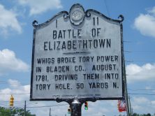
Whigs broke Tory power in Bladen Co., August, 1781, driving them into Tory Hole, 50 yards N.Plaque via North Carolina Highway Historical Marker Program, and is used with their permission. Full...
- ncmarkers
- north carolina
CROSS CREEK
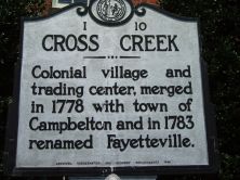
Colonial village and trading center, merged in 1778 with town of Campbelton and in 1783 renamed Fayetteville.Plaque via North Carolina Highway Historical Marker Program, and is used with...
- ncmarkers
- north carolina
OLD BLUFF CHURCH

Presbyterian. Organized in 1758 by Rev. James Campbell. Present building erected about 1858. N.W. 1 mi.Plaque via North Carolina Highway Historical Marker Program, and is used with...
- ncmarkers
- north carolina
CONFEDERATE CEMETERY

The remains of 360 Confederates who fell in the Battle of Bentonville lie here. They were moved to this plot from other parts of the battlefield in 1893. The monument was erected at that...
- ncmarkers
- north carolina
UNION HOSPITAL

Field Hospital of the XX Corps during the Battle of Bentonville was located here. Four hundred Union soldiers, wounded in the Battle of Averasboro (16 miles west) on March 16, were brought here...
- ncmarkers
- north carolina
FEDERAL EARTHWORKS

Constructed by First Michigan Engineers and others, March 19, 1865. Occupied by Federals throughout the battle. Works begin 75 yards behind this marker.Plaque via North Carolina Highway Historical...
- ncmarkers
- north carolina
UNION HEADQUARTERS
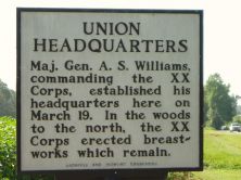
Maj. Gen. A. S. Williams, commanding the XX Corps, established his headquarters here on March 19. In the woods to the north, the XX Corps erected breastworks which remain.Plaque via North...
- ncmarkers
- north carolina
CONFEDERATE HOSPITAL

Following the battle, 45 Confederate wounded were hospitalized in the Harper House. Nineteen of these men died here. Surgeons moved the others to regular Confederate hospitals.Plaque via...
- ncmarkers
- north carolina
UNION LINE-- MARCH 20

Trenches in the woods behind this marker formed the extreme right of the Union line on March 20. This sector was occupied by the XVII Corps, commanded by Maj. Gen. F. P. Blair.Plaque via North...
- ncmarkers
- north carolina
UNION HEADQUARTERS

Sherman's headquarters were located in the field 400 yards to the rear of this marker, March 20-21, 1865. Headquarters of the XVII Corps, which included Mower's Division, were 250 yards to...
- ncmarkers
- north carolina
UNION LINE-- MARCH 21

After withdrawing from the advance against Mill Creek Bridge, Mower's Federals reformed here and threw up works. This was the extreme right of the Union line on March 21. Earthworks...
- ncmarkers
- north carolina
MOWER'S ATTACK

Advancing toward Mill Creek Bridge, Johnston's only line of retreat, Maj.Gen. J. A. Mower's Union Division broke the Confederate line near this point, March 21. Mower's Division reached a...
- ncmarkers
- north carolina