
FORT BUTLER
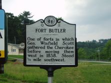
One of forts in which Gen. Winfield Scott gathered the Cherokee before moving them west in 1838. Stood 1/4 mile southwest.Plaque via North Carolina Highway Historical Marker Program, and is...
- ncmarkers
- north carolina
YONAGUSKA ca. 1760-1839

Chief of Oconaluftee Cherokee. He advocated temperance and opposed removal of his people from their homeland. Lived in this vicinity.Plaque via North Carolina Highway Historical Marker...
- ncmarkers
- north carolina
CHEROKEE INDIAN RESERVATION

Established by United States for the Eastern Band of Cherokee after the removal of 1838. (Reverse) (LEAVING) CHEROKEE RESERVATION / Established by United States for the Eastern Band of...
- ncmarkers
- north carolina
CHEROKEE INDIAN RESERVATION

Established by United States for Eastern Band of Cherokee Indians after removal of 1838. (Reverse) (LEAVING) Established by United States for Eastern Band of Cherokee Indians after removal...
- ncmarkers
- north carolina
FORT HEMBREE

One of the forts where General Winfield Scott's United States forces gathered the Cherokee before moving them west, stood 3/4 mi. N.W.Plaque via North Carolina Highway Historical Marker...
- ncmarkers
- north carolina
ELLEN BLACK WINSTON 1903-1984

Social worker. Led N.C. Board of Public Welfare, 1944-63; first Commissioner of U.S. Welfare. Her grave is 1/10 mi. W.Plaque via North Carolina Highway Historical Marker Program, and is used with...
- ncmarkers
- north carolina
JUNALUSKA ca. 1779-1858

Cherokee warrior, fought for U.S. in Creek War, 1814. Granted citizenship and land by N.C., 1847. Grave is one mile S.W.Plaque via North Carolina Highway Historical Marker Program, and is...
- ncmarkers
- north carolina
NORTH CAROLINA- GEORGIA

NORTH CAROLINA / Colonized, 1585-87, by first English settlers in America; permanently settled c. 1650; first to vote readiness for independence, Apr. 12, 1776 b/w GEORGIA / The colony of...
- ncmarkers
- north carolina
TSALI

Cherokee who resisted removal & escaped from U.S. troops; executed nearby, 1838. Story inspired Unto These Hills.Plaque via North Carolina Highway Historical Marker Program, and is used with...
- ncmarkers
- north carolina
INDIAN BOUNDARY

Near here the highway crosses Meigs-Freeman Line, surveyed in 1802, boundary between whites & Cherokees until 1819.Plaque via North Carolina Highway Historical Marker Program, and is used with...
- ncmarkers
- north carolina
NORTH CAROLINA- GEORGIA

NORTH CAROLINA / Colonized, 1585-87, by first English settlers in America; permanently settled c. 1650; first to vote readiness for independence, Apr. 12, 1776 b/w GEORGIA / The colony of...
- ncmarkers
- north carolina
POTTERY CLAY

Wedgwood potteries, England, used several tons of clay taken in 1767 from a nearby pit by Thomas Griffiths, a South Carolina planter.Plaque via North Carolina Highway Historical Marker...
- ncmarkers
- north carolina
GEORGE W. TRUETT

Pastor First Baptist Church, Dallas, Texas, 1897-1944, president of Baptist World Alliance. His birthplace stands one mile northwest.Plaque via North Carolina Highway Historical Marker Program,...
- ncmarkers
- north carolina
WESTERN CAROLINA UNIVERSITY

Established in 1889 as a private school. Has been a state supported institution since 1893.Plaque via North Carolina Highway Historical Marker Program, and is used with their permission. Full page...
- ncmarkers
- north carolina
COWEE

Principal settlement of the Cherokee Middle Towns. Council house stood on mound 300 yds. S. Town destroyed during the Revolution.Plaque via North Carolina Highway Historical Marker Program, and...
- ncmarkers
- north carolina