

LANE'S EXPEDITION

Ralph Lane and a group of English colonists explored the Chawanook Indian country and the Chowan River, 1586, north to this vicinity.Plaque via North Carolina Highway Historical Marker Program,...
- ncmarkers
- north carolina
POTECASI CREEK

Scene of minor skirmish between Confederate & Union troops driving on Richmond and Weldon Railroad, July 26, 1863. Breastworks 60 yds. SW.Plaque via North Carolina Highway Historical Marker...
- ncmarkers
- north carolina
'SCOTCH HALL'

Plantation setting for the novel "Bertie" by George R. Throop (1851), tutor in the family of Geo. W. Capehart. House built 1838 is 8 mi. S.E.Plaque via North Carolina Highway Historical Marker...
- ncmarkers
- north carolina
DR. WALTER REED

Head of U.S. Yellow Fever Commission in Cuba, 1900-01. Lived here as a young man and married Emily Lawrence of this town.Plaque via North Carolina Highway Historical Marker Program, and is used...
- ncmarkers
- north carolina
THOMAS CHILD

Attorney-General of Colony, 1745-1761. Leader of faction which opposed Governor Dobbs. Secretary to Lord Granville. Home was 2 blocks S.Plaque via North Carolina Highway Historical Marker...
- ncmarkers
- north carolina
BARKER HOUSE

Home of Thomas Barker, N.C. agent to England, and his wife Penelope, reputed leader of the Edenton "Tea Party," 1774. Stands 3 blocks south.Plaque via North Carolina Highway Historical...
- ncmarkers
- north carolina
GEORGE W. BROOKS

Federal judge whose writ of habeas corpus, 1870, prevented arbitrary arrest of N.C. citizens during Reconstruction. Home was 1/4 mile east.Plaque via North Carolina Highway Historical Marker...
- ncmarkers
- north carolina
ROANOKE RIVER

Early channel of trade, its valley long an area of plantations. Frequent floods until 1952; since controlled by Kerr Dam. Old name was "Moratuck."Plaque via North Carolina Highway Historical...
- ncmarkers
- north carolina
JAMES IREDELL 1751-1799
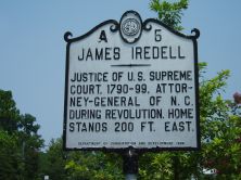
Justice of U.S. Supreme Court, 1790-99. Attorney General of N.C. during Revolution. Home stands 200 ft. east.Plaque via North Carolina Highway Historical Marker Program, and is used with...
- ncmarkers
- north carolina
JAMES IREDELL, JR. 1788-1853

Governor, 1827-28; U.S. Senator; and legislator. Compiler of revisal of N.C. laws. His home two blocks south; grave at Hayes one mile S.E.Plaque via North Carolina Highway Historical...
- ncmarkers
- north carolina
4-H CLUB
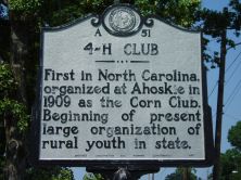
First in North Carolina, organized at Ahoskie in 1909 as the Corn Club. Beginning of present large organization of rural youth in state.Plaque via North Carolina Highway Historical Marker...
- ncmarkers
- north carolina
FIRST ASSEMBLY

In 1665 the Albemarle County Assembly, the initial lawmaking body in Carolina, met in this area. Convened by Wm. Drummond, governor.Plaque via North Carolina Highway Historical Marker Program, and...
- ncmarkers
- north carolina
YEOPIM

Reservation established for Yeopim Indians in 1704; sold after 1739. Northern boundary nearby; village was 2 miles S.E.Plaque via North Carolina Highway Historical Marker Program, and is used with...
- ncmarkers
- north carolina
WEAPEMEOC

The principal town of the Weapemeoc Indians, visited by Ralph Lane and his colonists in 1585-1586, stood near present-day Edenton.Plaque via North Carolina Highway Historical Marker Program, and...
- ncmarkers
- north carolina
JOHN W. MOORE

Compiler of roster of North Carolina troops, 1861-1865, historian, novelist, Confederate major. His birthplace, "Mulberry Grove," 1 1/2 mi. E.Plaque via North Carolina Highway Historical Marker...
- ncmarkers
- north carolina
MOUNT LEBANON CHURCH

A.M.E. Zion. Organized about 1850 as mission to serve black Methodists. Since 1856 congregation has met 1 1/2 blocks N.Plaque via North Carolina Highway Historical Marker Program, and is used with...
- ncmarkers
- north carolina
WILLIAM REED

Acting governor, 1722-1724; president of the Provincial Council. His home stood 3/4 mile east.Plaque via North Carolina Highway Historical Marker Program, and is used with their permission. Full...
- ncmarkers
- north carolina
WILLIAM BLOUNT

Member of Continental Congress, signer of the Federal Constitution, governor S.W. Territory, Senator from Tennessee. Birthplace 1/5 mi. S.W.Plaque via North Carolina Highway Historical Marker...
- ncmarkers
- north carolina
STEPHEN B. WEEKS

Historian, bibliographer, collector of North Carolina books and manuscripts, professor at Trinity College, 1891-93. Birthplace 3/5 mi. E.Plaque via North Carolina Highway Historical Marker...
- ncmarkers
- north carolina
JOSEPH HEWES

Signer of Declaration of Independence, leader in Continental Congress, merchant. His store was three blocks S.Plaque via North Carolina Highway Historical Marker Program, and is used with...
- ncmarkers
- north carolina