GRANVILLE GRANT
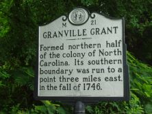
Formed northern half of the colony of North Carolina. Its southern boundary was run to a point three miles east, in the fall of 1746.
Plaque via North Carolina Highway Historical Marker Program, and is used with their permission. Full page here (NC Marker ID M21)