The Muskoka Road 1858
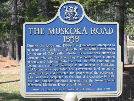
During the 1850's and 1860's the government attempted to open up the districts lying north of the settled townships by means of "Colonization Roads". Free land was offered to persons who would settle along the route, clear a stated acreage and help maintain the road. In 1858 construction began on a road from Washago to the interior of Muskoka. R.J. Oliver was appointed the government land agent at the Severn Bridge and directed the progress of the settlement. The road was completed to the site of Bracebridge by 1861 and the adjacent bushland formed into the townships of Morrison, Muskoka, Draper and Macaulay.
Plaque via Alan L. Brown's site Ontario Plaques. Full page here.