

FORT ANDERSON

Large Confederate fort stands 13 mi. S. After a strong Union attack it was evacuated Feb. 18, 1865, resulting in the fall of Wilmington.Plaque via North Carolina Highway Historical Marker Program,...
- ncmarkers
- north carolina
FORT ANDERSON

Large Confederate fort stands 2 mi. E. After a strong Union attack it was evacuated Feb. 18, 1865, resulting in the fall of Wilmington.Plaque via North Carolina Highway Historical Marker Program,...
- ncmarkers
- north carolina
PRISONER EXCHANGE

Thousands of Civil War soldiers, including many held in Confederate prison at Salisbury, were exchanged here, Feb. 26-Mar. 4, 1865.Plaque via North Carolina Highway Historical Marker Program, and...
- ncmarkers
- north carolina
BROMINE EXTRACTION

Ethyl-Dow plant, which operated here, 1934-1945, pioneered extraction of bromine from sea water. Element used in Ethyl, anti-knock gas compound.Plaque via North Carolina Highway Historical Marker...
- ncmarkers
- north carolina
LUMINA

Built in 1905; known as "Fun Spot of the South"; hosted big bands, other entertainment. Pavilion was demolished, 1973. Stood 100 yards east.Plaque via North Carolina Highway Historical...
- ncmarkers
- north carolina
NORTH CAROLINA SHIPBUILDING CO.

Constructed 243 vessels at shipyard one mile west, 1941-1946. Its first Liberty Ship, the S.S. Zebulon B. Vance, launched Dec. 6, 1941.Plaque via North Carolina Highway Historical Marker...
- ncmarkers
- north carolina
JAMES BENSON DUDLEY

Educator. President of what is now N.C. A. & T. University, 1896-1925. His grave is 5 blocks N.Plaque via North Carolina Highway Historical Marker Program, and is used with their permission. Full...
- ncmarkers
- north carolina
BABIES HOSPITAL

Pioneer pediatric hospital opened here in 1920 by Dr. J. Buren Sidbury. Also provided training of nurses. Closed 1978.Plaque via North Carolina Highway Historical Marker Program, and is used with...
- ncmarkers
- north carolina
ROBERT RUARK 1915-1965

Columnist and author. His 1957 novel The Old Man and the Boy based on childhood visits with grandparents 1 block W.Plaque via North Carolina Highway Historical Marker Program, and is used with...
- ncmarkers
- north carolina
DANIEL L. RUSSELL 1845-1908
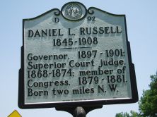
Governor, 1897-1901; Superior Court judge, 1868-1874; member of Congress, 1879-1881. Born two miles N.E.Plaque via North Carolina Highway Historical Marker Program, and is used with...
- ncmarkers
- north carolina
PENDERLEA HOMESTEADS

Established in 1934 as model farm community. Planned as a New Deal homesteading project of ten thousand acres.Plaque via North Carolina Highway Historical Marker Program, and is used with...
- ncmarkers
- north carolina
JAMES INNES ca. 1700-1759
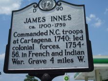
Commanded N.C. troops at Cartagena, 1740; led colonial forces, 1754-56, in French and Indian War. Grave 4 miles W.Plaque via North Carolina Highway Historical Marker Program, and is used with...
- ncmarkers
- north carolina
WHISTLER'S MOTHER

Anna McNeill Whistler, the mother of James Whistler, artist, was born in a house which stood one block east.Plaque via North Carolina Highway Historical Marker Program, and is used with...
- ncmarkers
- north carolina
JOSIAH MARTIN

Last royal governor of North Carolina, 1771-75. Fearing capture, in June 1775 he sought refuge here. Fled offshore to HMS Cruizer in July.Plaque via North Carolina Highway Historical...
- ncmarkers
- north carolina
GREGORY NORMAL INSTITUTE

School for blacks, 1868-1921. Founded by American Missionary Assoc. Named for benefactor James H. Gregory. Was 4 blocks E.Plaque via North Carolina Highway Historical Marker Program, and is...
- ncmarkers
- north carolina
THOMAS ATKINSON 1807-1881
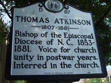
Bishop of the Episcopal Diocese of N.C., 1853-1881. Voice for church unity in postwar years. Interred in the church.Plaque via North Carolina Highway Historical Marker Program, and is used with...
- ncmarkers
- north carolina
USS NORTH CAROLINA

World War II battleship. Launched, June 13, 1940. Served in Pacific, 1942-1945. Decommissioned, 1947. Berthed here, 1961.Plaque via North Carolina Highway Historical Marker Program, and is...
- ncmarkers
- north carolina
BENJAMIN SMITH 1756-1826
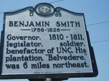
Governor, 1810-1811, legislator, soldier, benefactor of UNC. His plantation, "Belvedere," was 6 miles northeast.Plaque via North Carolina Highway Historical Marker Program, and is used with their...
- ncmarkers
- north carolina
N.C. BUILDING AND LOAN ASSOCIATION LEAGUE

Organized on June 25, 1903, at Seashore Hotel nearby. First president was Samuel Wittkowsky.Plaque via North Carolina Highway Historical Marker Program, and is used with their permission. Full...
- ncmarkers
- north carolina
JAMES F. SHOBER 1853-1889

1st known black physician with an M.D. degree in N.C. Practiced 1878-89. Home and office stood one block north.Plaque via North Carolina Highway Historical Marker Program, and is used with...
- ncmarkers
- north carolina